
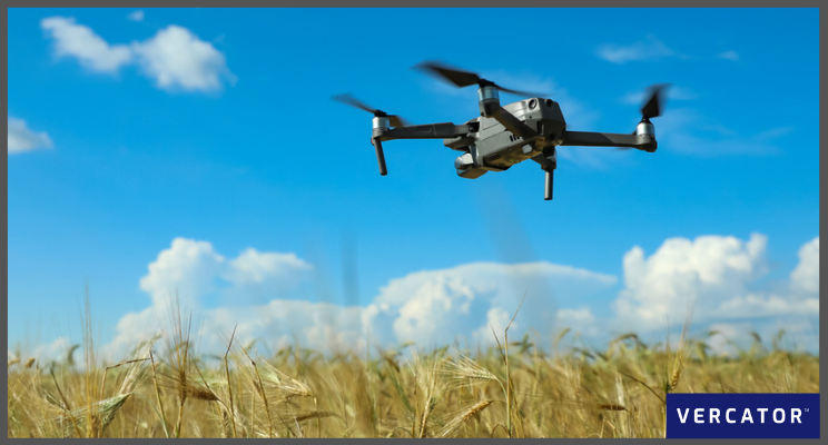
Mobile mapping systems are now the go-to technology for providing scan data for large-scale environments. Drone mapping is a vital part of that arsenal, gathering high-resolution imagery and sensor readings that can be applied to create accurate maps and models.
Drones, more formally known as unmanned aerial vehicles (UAVs) or unmanned aircraft systems (UAS), are beginning to play a role in numerous industries, from emergency services to construction. The scope of mapping drones is increasing, as is the type of drones being deployed. Mapping drones can vary in type and configuration from single-rotor, fixed-wing to hand-sized multi-rotor drones.
This article will look at how you can take your use of drones to the next level by integrating drone-based reality capture into multi-sensor workflows to maximise the value of your investment and create stunning deliverables.
Step 1: Understand the strengths and weaknesses of 3D mapping using drones
The application and potential of drones in 3D mapping solutions are increasing. In order to take your drone mapping deployment to the next level, it's crucial to recognise the associated strengths and weaknesses.
Strengths
Utilising drones for 3D land mapping can have a number of advantages for stakeholders, such as:
- Cost-effectiveness: The critical strength of mapping drones is that they are typically less expensive than crewed aircraft, as assignments can be automated, reducing the human resources required. Mapping drones can also be deployed at lower altitudes, leading to higher resolution images.
- Enhanced accessibility: Utilising drone flights reduces the need for surveyors to negotiate unknown terrain, and as a result can be instrumental in gathering data in hard to reach locations.
- Less Disruption: Since drones are capturing data overhead, on-site operations won't be interrupted.
- Time-saving: On larger sites, land surveyors using traditional methods can take days, even weeks to gather site information. Utilising drone images saves time. Capturing topographical data with a drone can be up to five times faster than with land-based procedures.
- Higher quality outcomes: Drone cameras can take a series of high-definition photos at different angles, creating thousands of accurate data points. Stakeholders can see more than a traditional survey would provide.
Weaknesses
While there are many pros to using drones, their deployment raises its own set of challenges. These include:
- Dependence on external factors: In bad weather, drones can struggle to capture usable scans or imagery and manoeuvre as well as they can normally.
- Legislative uncertainty: The law is still developing. UAVs still function in something of a regulatory grey zone.
- Drones are generally more appropriate in outdoor settings: Although smaller indoor device applications (such as tunnels and mines) are beginning to emerge.
- Outputs are produced separately: Stored separately, and are not felt to be intrinsic to a project.
Fundamentally, to get the most out of your investment, you need to maximise the strengths of drones and minimise weaknesses. To do this, and take your drone mapping to the next level, you must exploit the power of integrated workflows and cloud software.
Step 2: Create integrated workflows (using the right processing software)
A different approach to 3D scanning hardware, software and survey methodologies is needed to support integrated drone-based survey workflows. Survey operations and workflows must embrace scan technologies. By deploying cloud-based registration software, you can provide a versatile and efficient means of creating new workflows for your surveys.
Today, UAVs, SLAM (Simultaneous Localisation and Mapping) and mobile scanners can easily complement 3D LiDAR and total stations as part of a connected survey workflow. For example, using traditional surveying to establish a control network of known ground points, you can then use LiDAR, SLAM, and drone-based scanning to build up more detailed data collection throughout the project. Specifically, you can:
- Use traditional, static scanners, where needed, for detail and accuracy.
- Deploy drone mapping to benefit from wide coverage, repeatability, and cost.
To bring these strengths together, you will need high-speed, robust, automatic alignment of potentially thousands of disparate scans. The way to do this is to combine advances in vector-based processing software with the cloud.
The critical importance of such software is to enable interoperability between different types of scan technology, whether LiDAR, photometry or IR, and even other types of hardware.
Without being hardware agnostic, it isn't easy to take your surveying to the next level by introducing new technologies and techniques into your workflows.
Step 3: Focus on deliverables
Combining scans and scanner technologies is all very well. But remember, this is not a technology nicety. There are real benefits to tying scans together:
- Safeguarding consistency and quality of data.
- Maximising the impact of how your information is presented.
- Ensuring data can be used further down the line.
Building Information Modelling (BIM) is an excellent example here. BIM aims to capture, update, collate and distribute data in a standard format — from feasibility planning through the initial design to construction, facilities management and, ultimately, demolition.
These are just some ways integrating drone output into a workflow can contribute to a BIM process:
- Structural inspections: One of the most dangerous parts of any engineering process is conducting structural inspections. Drones enable you to carry out site inspections before construction commences to create a benchmark for future stages.
- Progress updates throughout the build: Aerial images are an ideal way to get a new project underway. By taking photos and scans throughout the build process, stakeholders can be made aware of progress. When a drone is integrated into surveying workflows, the data is more realistic.
- Project completion checks: Drones can contribute to the checks and evaluations needed once a project is complete. Whether this is by aerial photography or thermal imaging to ensure that everything is sound structurally. Thermal imagery can also be used to work out the energy efficiency of the building.
- Government regulation compliance: Depending on the type of project, there could be a sizable involvement from local authorities. Capturing any necessary information and imagery during the project will enable compliance to be demonstrated as part of the project rather than as a costly after-thought.
Step 4: Optimise processing and presentation in the cloud
Any next level 3D mapping process must involve the cloud. As we have covered with regard to BIM, sharing the same mapping data is crucial to everyone being on board throughout a project. With many stakeholders involved in any project, they will each have different implementation needs with different agendas and even different time zones.
Cloud implementation captures data from many locations, can set benchmarks for data alignment, and simplify downstream analysis by presenting the right level of detail to the right stakeholders.
Cloud impacts in several ways:
- Accelerated processing: Scalability of computing power in the cloud leads to "parallelisation" — the simultaneous execution of many computing tasks. With the right software, you can dramatically accelerate the registration of large data sets from many sources.
- Resilient and up-to-date infrastructure: Performance improvements, with almost continuous updates, bring new levels of functionality
- Centralised data: It is easier and cheaper to process and share the data at each workflow stage by storing project information in the cloud.
Additional reading: If you want to learn more about the cloud's role in the future of surveying, check out our eBook — Are You Ready for the Cloud?
Software holds the key
It's imperative to make the best scanner choices to prosper in this software-driven world. Next-level reality capture demands using drone technology solely for its strengths. A multi-scanner workflow is essential to achieve this. Partnering multiple scanner types with third-party processing software will provide the needed agility, flexibility and speed.
Here at Vercator, we believe cloud software will drive the best outcomes. If you're interested in how Vercator Cloud can help transform your 3D land mapping, get in touch with us today.
Suggested reading: If you want to learn more Vercator’s journey and our software, check out our blog — The Vercator Roadmap - Where We Started and Where We are Going

Tags: laser scanner, Vercator, land mapping, drones
