
Roads & highways need to be maintained for safety and reliability for the traffic that use them. They represent important infrastructure for countries and are often managed by local or national governmental bodies. Due to their scale and differing terrain they pass through, it can be a huge challenge and manual work to inspect them for safety and condition monitoring. This also makes it costly. The UK, for example, spent £41,000 per mile to maintain its main highways in 2010; many millions of pounds for all 4,300 miles (~7000km) and that is without accounting for local roads.
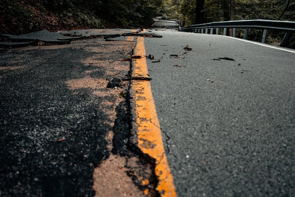
Possibly the most common fault in roads and highways manifest as potholes - depressions in the road surface or pavement. Potholes are bad for roads because they can damage vehicles and make the road less safe to drive on. When a pothole forms, it creates an indent in the road surface. This indent can cause vehicles to lose control and in the worst cases result in accidents. Additionally, potholes can make it difficult for vehicles to navigate the road or cause drivers to take unnatural routes in the road, which can cause traffic delays or risks. Over time, potholes also weaken the overall structure of the road, especially in adverse weather, which can lead to more serious damage and costly repairs, therefore prompt fixing is desirable to save greater expenses later.3D data capture of roads & highways
Measurement systems based on LiDAR scanning are being widely adopted in the civil engineering sector producing dense 3D point cloud data. Here, useful information is abstracted from 3D point clouds created from scans of objects and scenes of interest. Such techniques have direct applicability to the monitoring and maintenance of the road network through the use of vehicle-mounted mobile mapping systems or drone-based 3D capture.
With ubiquitous accurate measurement of the state of the linear asset, better decisions can be made on road infrastructure capability, design, maintenance and renewals; better information on the status of the “fixed” infrastructure, its rate of degradation and behaviour, supports prioritised maintenance interventions much more effectively, reducing the number of times that staff are required to go on or near the road (a health & safety risk in itself), and easing the workload of engineers, vastly improving their productivity.
The downside of these systems is the volume of data produced, either from vehicle-based mobile mapping systems or more specialist Road Assessment Vehicles. This is where it is vital that smart software is chosen, to crunch that data in a quick and efficient way to deliver actionable insights.
The Vercator approach
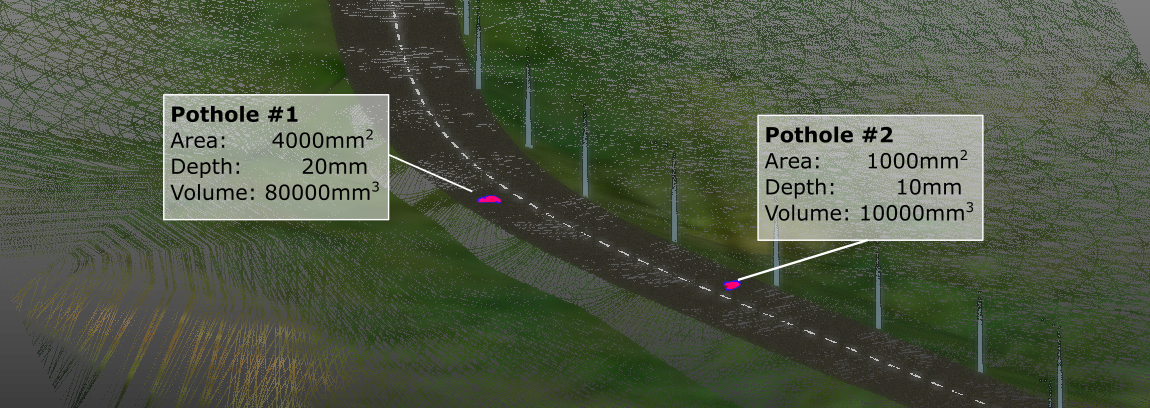
Vercator uses this 3D point cloud data and applies the state of the art in point cloud 3D object recognition to get automatically classified results of the highway environment. Vercator applies AI through machine learning and advanced computer models to identify and categorise objects and structures along a road or highway route. From this it is possible to measure where interventions are required to fix potholes and calculate the amount of backfill material required to remedy it. The system can also support more informed planning of route enhancements and other works too.
The outputs of Vercator’s processing move engineers on from low-level work identifying potholes manually from imagery and other data, to being able to focus on high added-value work and setting proactive intervention strategies on routes to either maintain or improve road condition, and to identify problems quickly and easily as they appear, such as with stressed material indicating a pothole beginning.
The use of this technology is applicable in road maintenance and the design of renewals and upgrade projects, during construction and as a post-construction validation, since the processing time will be shortened from months to days or hours with Vercator.
Delivering this solution from the cloud brings with it the associated benefits of ease of access, scalable (and therefore fast) processing, data security and flexibility. Vercator, being cloud-based, means there is no requirement for the operator to invest in IT hardware, so the risk of obsolescence is removed, while the service is retained. The broad-based range of customers also supports longer-term development and commercial viability.
Ultimately, with labour and contractor costs rising, road condition maintenance programmes need to be optimised and expeditious to optimise budget & reliability for the operator, their users and the system. The Vercator approach presents one part of the puzzle to help do this by leveraging cutting edge AI for road condition monitoring.
Try the Vercator cloud classification for yourself, or if you have a workflow challenge why not have a chat with us?

