
3D surveying is filled with complex jargon. What is LiDAR? How does it relate to point clouds, reality capture and the basics of 3D surveys? This is exactly what we are going to explain here, giving you insights into the 3D standards of modern surveying.
According to a Research and Markets report, the global Light Detection and Ranging (LiDAR) market should reach $4.5 Billion by 2022 from $1.5 Billion in 2017 at a CAGR of 24.0%. With space exploration, automotive, military and defence, energy sector, construction, environmental and mining all quoted as significant market growth segments, the impact of LiDAR will be widespread.
If LiDAR hasn’t impacted your industry yet, it is likely to soon. Advances in point cloud processing are making LiDAR more accessible than ever. So now is the time to learn something about LiDAR and understand its relation to point clouds.
What is LiDAR?
LiDAR is more of a methodology than a technology. Although now most sources treat the word "LiDAR" as an acronym, the term originated as a combination of "light" and "radar". When LiDAR was first proposed in the 1960s, lasers and detection mechanisms were bulky and slow to operate — all that is changing rapidly.
Basically, LiDAR is a remote sensing process which collects measurements used to create 3D models and maps of objects and environments. Using ultraviolet, visible, or near-infrared light, LiDAR gauges spatial relationships and shapes by measuring the time it takes for signals to bounce off objects and return to the scanner.
LiDAR describes the technological tools that deliver this outcome. But, more accurately, it describes this ‘time-of-flight’ measurement process. A good analogy for understanding this is the echolocation used by bats to determine where objects are and how far away.
LiDAR can target a wide range of materials, including non-metallic objects, rocks, rain, chemical compounds, aerosols, clouds and even single molecules. A narrow laser beam can map physical features with very high resolutions — for example, an aircraft can map terrain at 30cm (12 in) resolution or better.
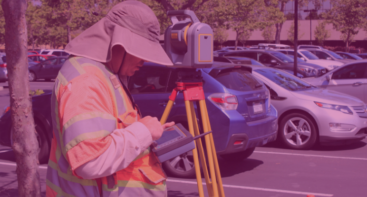
When using LiDAR, stationary terrestrial scanning is most common as a survey method, for example in conventional topography, monitoring, cultural heritage documentation and forensics. Terrestrial LiDAR is usually carried out from a scanner set on a tripod, although terrestrial applications of LiDAR (terrestrial laser scanning) are increasingly becoming mobile. Mobile LiDAR can be mounted on a backpack, or on a vehicle (car or train) with a very large point density and relatively rapid data collection.
LiDAR challenges
As with any application of state-of-the-art technology, LiDAR has its challenges and it is worth noting these to understand both its potential and limitations. The main challenges can be summarised as:
- Line of sight access is needed
- Reflective surfaces can cause problems for the laser
- Bad weather can interfere with data collection
While much is being invested in addressing some of these challenges, especially in the use of LiDAR with autonomous vehicles, the application of LiDAR to stationary objects is a more proven case at this stage. It is also the more accurate means of deploying the technology and methodology.
How does LiDAR work
LiDAR systems send out pulses of light just outside the visible spectrum and register how long it takes each pulse to return. The direction and distance of whatever the pulse hits are recorded as a point of data. Different LiDAR units have different methods, but generally they sweep in a circle like a RADAR dish, while simultaneously moving the laser up and down.
Once the individual readings are processed and organised, the LiDAR data becomes point cloud data. The initial point clouds are large collections of 3D elevation points, which include x, y, and z, along with additional attributes such as GPS time stamps if available.
The specific surface features that the laser encounters can be classified further after the initial LiDAR point cloud is processed. Elevations for the ground, buildings, forest canopy, motorway overpasses, and anything else that the laser beam encounters during the survey constitutes point cloud data.

Where do point clouds fit in?
Point clouds are a powerful and dynamic information storage technology. By representing spatial data as a collection of coordinates, they can handle large datasets for a wide array of downstream processing. Primarily, in this instance, they are used as a middleman to turn the raw data collected by LiDAR processes into 3D models. However, they can be used to store and manipulate any spatial information.
A 3D point cloud is a collection of data points analogous to the real world in three dimensions. Each point is defined by its own position and (sometimes) colour. The points can then be rendered as pixels to create a highly accurate 3D model of the object. Point clouds can describe objects measuring just a few millimetres or objects as large as trees, buildings and even entire cities.
LiDAR and point clouds
While LiDAR is a technology for making point clouds, not all point clouds are created using LiDAR. For example, point clouds can be made from images obtained from digital cameras, a technique known as photogrammetry. The one difference to remember that distinguishes photogrammetry from LiDAR is RGB. In other words: colour. Photogrammetric point clouds have an RGB value for each point, resulting in a colourised point cloud. On the other hand, when it comes to accuracy, LiDAR is hard to beat.
But, not all projects require the same level of accuracy, which is why it is always good to do some research first before deciding which method works best. Acquisition time and processing time have to be taken into account. Factors involved here include the scale of scanning required, the accuracy of detail needed and how the results of the scan are to be used.
Point clouds processing and registration
Knowing the precise location of a scanner is essential to producing usable data. This is because laser scanners (like GPS) are functionally limited to line-of-sight measurements. In order to map a complex physical space, multiple scans are normally required to achieve enough coverage for downstream processing. Depending on the size of the project, the necessary number of scans can stretch into the hundreds if not thousands.
Fortunately, changes to how point cloud processing is undertaken are significantly reducing the cost of carrying out a 3D survey. For outdoor, low accuracy, large scale projects, this is being delivered by GNSS positional data. High-precision projects have benefited from the development of new, multi-stage point cloud processing technology delivering automated and accelerated registration of multiple scans without the use of targets — something worth investigating if looking to commission a survey.
The advances are opening up the ability to capture spatial data in a point cloud to an ever-increasing number of projects. Without point cloud technology, LiDAR would not be able to realise its massive growth potential — one is totally dependent on the other.

Tags: point clouds
