How much does a 3D laser scanner cost and when is it the right investment?
From construction to medical research, civil engineering to manufacturing, we are seeing an increase in the application of 3D scanners. Widespread adoption of cloud computing services, shifts to remote working, as well as digital planning and modular construction, are expected to further growth opportunities in the market.
The 3D laser scanner options open to reality capture professionals are numerous, with an increasing amount of considerations essential before any purchase, including software. Not all scanners are compatible with every software solution, so thinking about the software you’re using today and may use in the future, is essential.
Considering variables amongst the different types of scanner is also important. Once you’ve looked at the capabilities of scanners currently available on the market, you can begin to align your desired outcomes with the options you have. That’s not the end of the journey, however. As with every purchase, pricing inevitability comes into the equation. Scanner prices will vary, depending largely on your outcomes. You could pay as much as £1,000,000, or as little as £10,000 in some cases.
Here, we’re going to take a look at the 3D laser scanner market. First, by examining the outcomes and variables referenced above, then by walking through the different types of scanner, their subcategories, and the all-important price ranges associated with each. So, let’s get started.
Suggested reading: If you want to learn more about trends in 3D surveying, take a look at our blog — 2021 Trends in 3D Surveying and Reality Capture.
Focus on outcomes first
Only you know what you need from your scanner, and what capabilities you need to introduce into your workflow. Start with the outcomes you want to achieve and work backwards to select a scanner that will enable these. You might want to:
1. Introduce more mobility into your workflows.
Consider using: SLAM or vehicle-based scanners paired with terrestrial laser scanners.
2. Make precise measurements at long range.
Consider using: Long-range terrestrial laser scanners.
3. Capture a huge territory in a short period of time at a low level of detail.
Consider using: Aerial- or vehicle-based scanners.
4. Take precise and repeatable object measurements in a controlled environment.
Consider using: Arm scanners or terrestrial laser scanners.
5. Deliver engineering-grade measurements at a medium range.
Consider using: Medium range terrestrial laser scanners.
Consider using: Terrestrial laser scanners with dual access compensation.
Each of these outcomes requires a different scanner. What’s more, you need to consider how your existing scanner impacts that choice — with regards to both compatibility and overlapping capabilities.
To focus on the right outcomes, consider variables like:
- Range: At what distance are you trying to make measurements — or what size of object are you measuring?
- Accuracy: How much detail do you need to capture? For example, do you need to take engineering-grade measurements based on your scans, or is it just to provide a visual representation of an area?
- Mobility: Do you need mobile workflows, or can you accommodate static scans? This normally comes down to the speed and complexity of scanning. But mobility can come at the cost of accuracy, so it’s important to consider multi-scanner workflows if you’re looking to introduce more mobility into your operation.
- Weight: Do you need something light and portable? Or something solid and steady? A light scanner will be agile but more prone to movement (and resulting error) from environmental factors.
- Features: Do you need to capture colour or thermal data? Are things like dual access compensators needed to take measurements from a moving platform?
- Your existing solutions: What equipment do you already have? How does that impact compatibility and what capabilities do you need to add to your workflow?
The 4 Types of 3D Laser Scanner
3D laser scanners cover various instruments operating on differing principles, in distinct environments and with multiple levels of precision and accuracy. Although there are hundreds (if not thousands) of scanners on the market, there are only four distinct types of laser scanner, each with their own subcategories.
We’ve delved into these categories, looking at their use cases and prices, to help you align capabilities with outcomes and make a functional, well-informed purchasing choice.
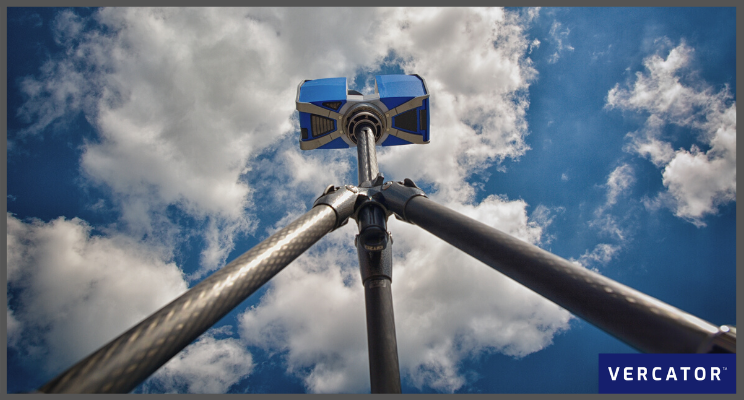
Type 1: Terrestrial Laser Scanners (TLS)
Terrestrial laser scanning (TLS) uses multiple static scans to provide detailed and accurate mapping in both indoor and outdoor environments. They require deliberate workflows but are the most versatile and (arguably) cost-effective scanners available.
Other than a few select scenarios, the real question is what other types of scanners can you use to augment the capabilities of your TLS.
The differences between TLS systems (in terms of cost and functionality) mostly comes down to range and accuracy. However, things like a scanner’s ability to pair with third-party software in a multi-scanner workflow are important to consider when comparing different models.

Short-range TLS |
Price point |
Accuracy |
Instrument Range |
|
£15k - £30k |
+/- 5mm - 10mm |
<30m |
|
|
Use cases: Capture targets like facades, crash sites, crime scenes and minor construction sites. Examples: Faro Focus 70, Leica BLK360 |
|||
Medium-range TLS |
Price point |
Accuracy |
Instrument Range |
|
£40k - £65k |
+/- 2mm - 10mm |
100m - 400m |
|
|
Use cases: These all-purpose work-horse scanners are ideal for gathering high-detail information in indoor and outdoor spaces. Examples: Faro focus 150/350; Leica P30/40/RTC360; Z+F Imager 5016 |
|||
Long-range TLS |
Price point |
Accuracy |
Instrument Range |
|
£85k - £150k |
+/- 5mm - 15mm |
1km - 6km |
|
|
Use cases: The go-to solution for civil engineering, topography and mining. Long-range scanners are used to measure large areas — e.g. forests and urban areas — especially if obstacles prevent operators from setting up near the scanned object. Examples: Riegl VZ-2000i, VZ-4000, VZ-6000; Maptek XR3, LR3; Leica P50 |
|||
Type 2: Mobile Mapping Systems (MMS)
Mobile mapping systems provide greater flexibility and faster reality capture capabilities than their static counterparts.
MMS has three main components: camera(s), LiDAR, and positioning system (e.g. SLAM, IMU, GNSS, or some combination). In terms of capabilities and use cases, there is a significant degree of variation within this category.
Vehicle scanners |
Price point |
Accuracy |
Instrument Range |
|
£250k - £500k |
+/- 20mm - 40mm |
120m - 360m |
|
|
Use cases: Scanners mounted on vehicles are ideal for mobile and large-scale registration. Often used for auditing and monitoring road and rail assets; checking telecommunication asset inventories; creating and verifying elevation models; creating 3D city models. Examples: Riegl VMX-2HA, Trimble MX-9, Pegasus II |
|||
Trolly scanners |
Price point |
Accuracy |
Instrument Range |
|
TBC |
+/- 2mm - 10mm |
30m - 360m |
|
|
Use cases: Trolly scanners bundle sensors on a device that can be pushed or propelled to capture scans. These are valuable for indoor and outdoor scanning but have some mobility and site limitations. Often used for railway track checking and BIM build progress monitoring. Examples: Leica ProScan, Faro Focus Swift, NavVis M6 |
|||
Wearable scanners |
Price point |
Accuracy |
Instrument Range |
|
£20k - £60k |
+/- 6 - 30mm |
25m - 100m |
|
|
Use case: Designed to be held or worn, wearable scanners enable rapid indoor scanning for small to medium-sized spaces. Great for repetitive scan requirements or restricted-access sites. However, the limited accuracy of mobile mapping (and SLAM specifically) means that these scanners are not suited to every job. Examples: Leica BLK2GO, NavVis VLX, GeoSLAM Zeb Horizon |
|||
Type 3: Metrology scanners
Metrology scanners have very specific use cases and deliver highly accurate, repeatable measurements used for 3D geometrical surface inspection. Arm mounted scanners are ideal in manufacturing contexts and capturing detailed information on a small scale.
Arm scanners |
Price point |
Accuracy |
Instrument Range |
|
> £100k |
0.004mm |
max 2m - 3m |
|
|
Use case: Ideal for cross-checking manufacturing production with planning with high accuracy. For example, looking for defects in an automated quality checking process or reverse engineering. Examples: Faro Quantum Scan Arms, Faro Super 6DoF TrackArm |
|||
Structured light scanners |
Price point |
Accuracy |
Instrument Range |
|
£10k - £27k |
+/- 0.02mm - 0.11mm |
TBC |
|
|
Use case: Widely used within heritage restoration and archaeology, their range limits use within broader reality capture contexts. However, it’s possible to stitch location-specific data from white light scanners into more comprehensive reality capture data sets of an entire scene — if you deploy the right software solution. Examples: Faro Freestyle 2, Artec Eva, Creaform HandyScan 3D |
|||
Type 4: Aerial Scanners
Aerial scanners are long-range, sophisticated and, unsurprisingly, expensive devices. These scanners can combine data from multiple inputs and are often used for global mapping — mounted to both drones and conventional aircraft.
Due to the financial and logistical considerations associated with aerial scanners, renting is often more appropriate than buying one outright.
Aerial (long-range) |
Price point |
Accuracy |
Instrument Range |
|
> £1m |
+/- 0.5m - 10m |
Kilometres |
|
|
Use case: Can deliver rapid and vast scene coverage, best suited to large-scale outdoor mapping, including use in navigation, meteorology, land surveys and cartography. Examples: Riegl VQ-1560 II, Leica CityMapper 2 |
|||
Aerial (short-range) |
Price point |
Accuracy |
Instrument Range |
|
£45k - £100k |
+/- 30mm |
Kilometres |
|
|
Use cases: Short-range aerial scanners provide similar capabilities on a smaller scale and lower price point. This makes them great for city planning, area mapping, ecological surveys and more. Examples: Emesent Hovermap, mdLiDAR1000-aaS |
|||
Focus on workflows and outcomes
Pricing is important, but so are outcomes. The first task in your purchasing decision should be to consider the variables which allow you to identify outcomes. Then you can align your use cases by thinking about workflow first.
Before rushing into a new scanner purchase, you also need to think about how your existing hardware investments could be augmented by software changes. It’s important to consider the long-term impact of different purchases, and how interoperability influences future workflow options.
In order to prosper in a software-driven world, it's imperative to make flexible hardware choices. Partnering multiple scanner types with third-party processing software provides agility, flexibility and speed.
Here at Vercator, we believe in using software to drive hardware-based outcomes. If you’re interested in how Vercator Cloud can help transform your existing laser scanners, get in touch with us today.