
According to recent reports, the global surveying and mapping market is expected to grow at a compound annual growth rate (CAGR) of 7.0% to nearly $49.9 billion by 2022. On top of that, it’s an industry with low entrance rates from young people, and a continuing skills shortage -- just like construction. It's never been easier to get started and differentiate yourself if you have the right skills.
Given fast economic growth, technological advances and increasing demand for environmental surveying, the surveying profession is set for a bright future. There are more than 100 varied career roles across the surveying profession in three main sectors: construction and infrastructure, property, and land.
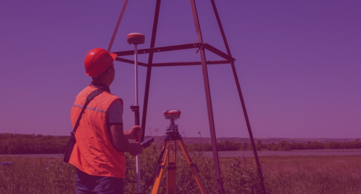
What do surveyors do?
Surveyors keep traffic flowing, water running and people moving. They shape our roads, bridges and tunnels, our skyscrapers, stations and stadiums. They work in mines and in fields, on cliffs and on beaches. From coastal erosion and flood defences to town and environmental planning, surveyors play a huge role in how we live. And with climate change and resource scarcity becoming ever-more important issues, surveyors will have an even greater role in shaping the future.
Surveyors work in the most technologically advanced, specialist roles, playing a key part in a wide range of civil engineering and construction projects. As a surveyor, you'll measure and collect data on specific areas of land, including information about boundaries, buildings and features, both natural and man-made. Surveyors map the shape of the land so that accurate site plans can be made for a range of purposes, including:
- Cartography
- Construction
- Geographical information systems (GIS)
- Property
- Offshore engineering and exploration
You'll also assess land due for redevelopment and survey a range of different areas, including airports, landfill sites, mines and quarries, and pipeline and distribution systems.
Responsibilities
As a surveyor, you'll need to:
- understand data from a range of sources, such as aerial photography, satellite surveys and laser beam measuring systems
- use computer-aided design (CAD) and other IT software to interpret data, and present it as valuable information
- keep up to date with new and emerging technology
- provide advice to a variety of clients
- make use of GIS to analyse and interpret site features
- produce detailed information (subsequently analysed by planners, builders and cartographers)
- use a range of equipment to produce surveys, including GPS and conventional methods
- gather data on the earth's physical and man-made features through surveys
- process data
- undertake digital mapping
- think creatively to resolve practical planning and development problems
- manage and monitor projects from start to finish — you're more likely to do this once you're chartered.
What salary should you expect?
The 2018 Rewards and Attitudes Survey by the Royal Institution of Chartered Surveyors (RICS) and Macdonald & Company reports that the average salary was £48,529, with a bonus of £5,841.
- Starting salaries for land/geomatics surveyors are around £20,000 to £25,000.
- Experienced surveyors with chartered status earn around £25,000 to £45,000.
- At senior level, with management or partnership responsibilities, surveyors can earn salaries of up to £70,000.
What are the working hours?
Working hours for surveyors are mainly from 9am to 5pm, but this varies between locations and may not be the case when work is based overseas. Longer hours, weekend or shift work may sometimes be required to meet deadlines. Surveyors frequently work away from home and are often paid for travelling time. They may travel considerable distances within the UK.
Why should you want to be a surveyor?
Technology is transforming the world. And technology is changing surveying. As a surveyor, you will be working in one of the most exciting and dynamic industries with expanding possibilities to learn and grow in your career.
The vast majority of the RICS attitude survey participants would seem to agree with this, with the vast majority (83%) fairly or very satisfied with their job. And UK research shows that generally, highly skilled and highly paid digital jobs grow at twice the rate of non-digital jobs — and these are digital jobs.
You will be working with many of the latest innovations — from drones to augmented reality, artificial intelligence and even 3D-printed buildings. You will be mastering real-time information flows, making use of 5G mobile networks, and advanced AI and cloud services. Consider just some of the key developments you will be part of:
- Mobile mapping and laser scans — specialist drones, ground-penetrating radar and laser scanners enable surveyors to map and analyse anywhere on Earth.
- New ways of point cloud registration are changing the face of scanning. Point clouds represent X, Y, and Z coordinates of single points generated by many laser scans. Now they are being stitched together automatically (registered) in a fraction of the time. This provides fantastic opportunities to create faster, more detailed models on any building, landscape, device — whatever you point the scanners at basically.
- Internet of Things — smart objects, sensors and big data are beginning to help to plan and manage intelligent cities with less pollution, better public spaces and more connected communities.
- AI and virtual reality — artificial intelligence helps create augmented reality and 3D models, allowing people to tour buildings or inspect construction sites virtually and turning point cloud data into user experiences.
- Cloud computing — The cloud has transformed many industries and surveying is no different. Putting near infinite processing capacity and storage in the hands of surveyors will lead to new, more efficient ways of working. It will also open new markets and applications for surveying itself.
Given these trends, data analysis is going to account for an ever-more significant part of a surveyor’s workload. Surveyors who have developed the skills to analyse and interpret that data will be needed. To quote the RICS consultation report, it is critical for surveying professionals to be able to understand and utilise data effectively.
Another theme supporting the move to a digital future is the growth in the use of specialist software in the geospatial industry. The focus of the industry is shifting from the raw capabilities of hardware laser scanners to the potential that can be unlocked through learning to use and get the most from innovative software mentioned earlier. For example, 3D visualisation, modelling and automated point cloud registration.
Lifelong learning will become increasingly important. Surveyors need to become more proficient in the use of technology. But do not think it will be all about the technology — non-technical skills and emotional intelligence will still be key elements which contribute to the success of a professional surveyor.

Advice on things you should do to succeed
1. Understand what is needed
Work will be both office and site-based. You must expect to spend a good part of your time working outdoors and in all weather conditions. Surveys must be completed to deadlines, so you must have the ability to deal with the stress of meeting deadlines.
Overseas work is sometimes available, mostly on a short-term basis, although individuals may be sometimes required to remain abroad for a substantial period of time. You need to work out whether this sort of work-life balance is what you want to sign up to.
2. Get the right qualifications
Whichever study route you eventually decide to take, it’s always worth getting accredited by The Royal Institute of Chartered Surveyors (RICS). A chartered surveyor salary tends to be considerably higher (15% more), plus you will benefit from the seminars, training and events that the professional body put on for its members.There are various routes of entry to gaining a RICS accreditation; this can be via accredited courses, experience or the newer Associate pathway. .
One trend worth noting is that RICS is starting to offer more specialised certification modules for professionals working in specific areas. One example is Building Information Modelling (BIM), a catalyst for digitalisation brought about by point cloud technology. BIM is starting to dominate processes across the built environment, and certification gives reassurance to employers and clients that BIM practitioners follow accepted industry practices. BIM professionals will also be able to demonstrate their competencies to the sector. As the role of technology increases, you can be sure there will be more certifications to show capabilities in the use of emerging cutting edge technologies. But let’s look at initial study routes in a bit more detail.
University degrees: a ‘traditional’ route into surveying, there are a range of degrees available in property and construction-related subjects. Studying a RICS-accredited degree will qualify you for relevant training to become a chartered surveyor.
There are more than 300 courses at UK universities covering land, property and construction that are accredited by RICS. So, there's a surveying course suited for you — no matter where you want to study or what your career ambitions are.
Apprenticeships: an increasingly popular option, Appreticips provide a very effective way of learning skills, boosting your knowledge and gaining first-hand work experience. They enable you to gain transferable skills, secure long-term earning potential and progress your career.
Starting young: If still in secondary school, there is no reason to wait. There are a number of programmes designed to help kids get started on a path in surveying and construction. Thought up to counter the skills shortage in both industries, organisations like DEC (design... engineer… construct!) and Get Kids into Surveying offer fantastic resources to give the next generation a leg-up on the latest technology and training shaping the future of both industries.
3. Chose a field of study
The general category of surveying involves many smaller categories. You will want to research these topics before enrolling in a college or university program, so you can best tailor your studies. Just to give you a flavour, here are some of the topics related to surveying:
Geomatics: includes the collection, interpretation and reporting of geographical data.
Geodesy: is the science of geographical measurement and representation. It measures such things as the gravitational fields of the earth, tectonic plate movements, polar ice shifts, and tidal movement.
Photogrammetry: is the science of acquiring geographical data from photographs and photo images. This field includes studies in aerial photogrammetry and close-range photogrammetry.
Land management: is the study of the way land is used, to best take advantage of its geological structures.
4. Understand your skills
In addition to the knowledge gained from academic study, the core skill you should develop is design thinking, which is the ability to put processes in place that can generate creative problem-solving. This is where clients see the greatest value in the services they buy from surveyors. You will also need to have:
- good IT skills, including computer-aided design (CAD)
- commercial awareness
- technical knowledge and competence
- a logical and practical mind
- good oral and written communication skills
Surveying: starting your high-tech career
If you are going into surveying as a career, you are entering one of the fastest-expanding global markets. Throughout the world, the changing nature of mapping and spatial data management means that there will be significant demand for chartered surveyors. Your skills will be in demand by a multitude of organisations in both the private and public sectors. You can have your pick from:
- construction companies
- engineering contractors and consultants
- geophysics consultancy companies
- government agencies, local authorities and central government
- mapping companies
- mining companies
- rail companies
- specialist surveying and geomatics companies that provide services for areas such as property development, construction and heritage management
- utilities companies
To get a first foot on the ladder, look for university programs that will help you get an internship as part of your study. An internship is a placement with an actual surveyor, so you can learn real, on-the-job techniques and business practices, in addition to your classroom education. If you do well in your internship, it can also lead to full-time employment.
If you go down the apprenticeship route, you are already carrying out on-the-job training to recognised industry standards. This provides a great way to enter a global profession like surveying. Keep in mind the high demand for land surveyors.
Building for the future
Surveying is expected to grow by 10% in the next 10 years, and is considered an in-demand career. So, whatever your route, this is not a profession that is in decline — it is at the forefront of a digital transformation.
For anyone looking for a career for the future, both construction and surveying are great opportunities. In addition to experiencing growth, continued low uptake among young people creates valuable opportunities to get ahead for anyone with the foresight to see them.
Surveying is often considered a ‘muck and boots’ industry. And while there is truth to the fact the surveyors spend time outdoors, it’s a cutting edge profession that brings a paycheck to match. The future is digital. The built and natural environment sector is no exception to that rule. The adoption of digital innovation will be the determining factor in your continuing success.
We have barely scratched the surface of the possibilities that the combination of LiDAR, automated point cloud registration and cloud computing are creating. If you’ve seen a self-driving car before, you’ve probably seen the possibilities of LiDAR sensors. Point clouds are already being used in agriculture to identify the areas which require more water or fertiliser. Point clouds can even be used to see things underwater to help understand the depth, width and flow of rivers, monitoring the floodplains.
Today’s emerging technologies are a glimpse into the future of how we will pioneer better places for people. Yet to be a good surveyor, you will need to deliver confidence to clients through decision-making based on trusted knowledge, data and insight. It is a challenge that requires a combination of both technical and non-technical skills. But it is also an exciting challenge well worth taking.

Tags: surveyors
