
Registration is an essential step in point cloud processing that has a considerable bearing on the overall quality of the final combined dataset and any derived products, 3D models for example.
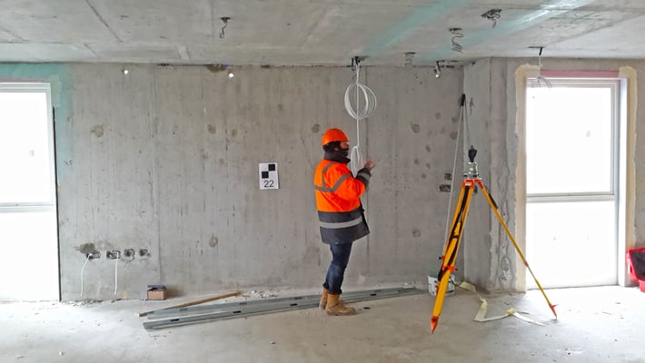
When using static terrestrial laser scanning methods, it’s only possible to capture measurements of the environment that are visible from the scan device position, so scanning within line of sight (LOS). Therefore, occlusions occur where objects in the environment block LOS from the scanner. To minimise this problem, multiple setups are used to extend LOS and ensure the required level of coverage is achieved. To allow multiple scans to be brought together into their correct position relative to each other, it is necessary to perform registration. The following registration methods outline the various approaches to the laser scanning workflow used by professionals in the construction industry.
Basic registration
The traditional approach to registration requires two steps per point cloud:
-
An estimation of the registration parameters
-
The application of the coordinate transformation
The latter is usually in the form of a 3D rigid body (i.e. 3 translations, 3 rotations, fixed scale). This estimation can be achieved through a number of methods used in isolation or combined: target-based, sensor-based, or data driven approaches. If the scanner is correctly levelled and its position known, e.g. surveyed in with a total station, then only one rotation around the vertical axis needs to be solved (Kappa rotation). The downside of obtaining the scan positions or targets with a total station is the amount of survey equipment required to do so, which results in a slower capture process and increases operational complexity.

Target-based registration
The most common method to register point cloud scans together is to use artificial targets; either patterned (such as black and white checkerboards or with a retro-reflective dot), geometric objects (such as spheres of known dimensions), or a combination. This provides a set of common observed points from which estimates of the registration parameters can be resolved. This method can give high accuracy registration as long as the rules of survey network design are followed. Survey professionals know all too well how time-consuming it is to plan and place the targets as well as survey them in. This has created a growing interest in automated registration techniques that do not need markers, such as Vercator, the new software toolkit from Correvate.
Sensor-based registration
This approach to registration uses information from sensors to give either an initial global or relative position for registration. Global Navigation Satellite Systems (GNSS) receiver is an example of the form of sensor that can be used to gain a position, although not inside buildings. Other sensors that are more usable indoors include an Inertial Measurement Unit (IMU) for rough relative position between scans, altimeter for height change and compass for the Kappa rotation around the Z axis.
Data-driven registration (natural features or cloud-to-cloud)
This form of registering point cloud data is generally performed by the iterative closest point (ICP) algorithm which has become the dominant approach to data-driven registration. This technique works by iteratively translating and rotating a free dataset to a fixed one through six degrees of freedom (6 DOF) until the transformation converges within a required tolerance.
The advantage of this form of point cloud registration is that it is targetless, meaning that the process is fully automated and removes the need for users to select targets as is typical with conventional registration software.
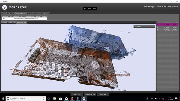
When using these types of algorithm, the scans need to be reasonably positioned for the process to converge correctly, accurately and quickly. One of the technical advances of Vercator is the novel data-driven registration for this initial coarse matching phase. This is currently subject to a patent application at an advanced stage. The ICP can then be performed as a fine or local registration step to ensure accurate, reliable and robust data.
To find out more about how Vercator can help improve your point cloud registration process, contact 020 7190 9683 or email info@correvate.co.uk.

Tags: pointcloud
