LiDAR and the cloud: evolving survey technologies

Technology never stands still. Constant improvements bring changes that can revolutionise an industry. What you need to be on the lookout for are technologies that have evolved separately that are now being applied together to create massive opportunities.
Some examples of this include the coming together of compute, GPS and mobile technologies to create the iPhone, or the combination of broadband, the internet and smart TVs to create streaming services such as Netflix.
One such evolution is the combination of laser scanning combined with cloud computing to deliver new possibilities in surveying. Possibilities that may go far beyond the construction industry and open up new markets and applications.
Survey technologies
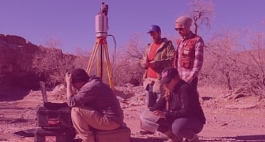
LiDAR is not a new technology by any stretch. The first LiDAR prototype was built in 1961, pretty soon after the invention of the laser itself. However, LiDAR and 3D scanning didn’t break into the mainstream until the late ’90s.
The scanners themselves had to mature in terms of accuracy, reliability and ease of use. As with all new devices, the software that controls them eventually went through the cycle of just making the devices work, to making them work better, to making them work better with other things.
Fundamentally there was a need to create, manage and process point clouds to better effect. This is being led by the independent development of processing software that is exploiting new artificial intelligence and machine learning techniques to create point clouds faster, with more certainty and less manual intervention. Specifically, it enabled workflows and processes to be created without manual oversight, allowing what is now cloud to be used to maximum effect.
It was also obvious from early days that 3D laser scanning could not advance without an improvement in compute technology. Even to this day, scan data from point clouds typically have to be delivered on external hard drives or USB drives, because the files are considered too large to transmit. Processing, bandwidth and storage had to increase and become more economical. But the evolution of survey technology has moved from the pursuit of better transmission speeds and cloud storage to transforming the role of surveying.
Cloud evolution
Cloud should no longer be looked on as cheap on-demand servers and storage, or an easy way of doing email or file sharing. There was a trend among early cloud adopters in many industries just to ‘lift and shift’ existing applications and data into the cloud. What we are seeing from the next phase of cloud adoption is an approach centred on real outcomes. Cloud is now being seen more as an enabler to move from a traditional way of doing business to a digital business. In the construction industry for example, it underpins the drive towards Building Information Modelling (BIM).
Such an industry-specific cloud approach would be able to handle data sources, workflows, and compliance with standards that are unique to construction. And by aggregating the resulting data, industry insights and benchmarks would naturally emerge. For example, an existing health care industry-focused cloud manages large volumes of electronic health record data with HIPAA compliance while also offering add-on health specific services like medical billing and care coordination.
Let’s look at how some emerging cloud developments will impact surveying and influence what we consider as surveying technology.
Processing power
We cannot get away from the fact that point cloud creation, registration and processing are compute and storage-intensive tasks. The good news is that the cloud still delivers on these fundamental needs.
Processor innovation is accelerating. Cloud vendors are now deploying their own in-house developed cloud-specific processors. Recently, AWS introduced M6g instances. These offer nearly 40% higher performance at 20% lower cost compared to Amazon’s own M5 instances, powered by Intel Xeon Platinum 8000 series. The company also announced machine learning specific instances. Powered by its custom-built Inferentia processor, this claims 3x higher throughput and up to 40 percent lower cost per inference compared to Nvidia G4 chips.
AWS already provides compute instances that are general purpose, compute optimised, memory optimised, accelerated compute, and storage optimised. For surveying technology, this range of capabilities just cannot be provided in-house and will give you the best price/performance options.
Stable modular infrastructure
Being able to process and store digital information from various sites to various stakeholders is crucial to getting the best out of surveying technology. The decision on where to process data — on device, on site, locally or centrally — will be key to the success of a project and is another feature that until recently wasn’t available with cloud.
For many years, there has been the concept of the hybrid cloud — some processing or applications staying in-house while others are processed in the cloud — but this has been carried out mostly by large corporations. Recent developments will make this model much more suited to the kind of distributed processing needed by surveyors.
AWS has teamed up with telcos to embed AWS hardware in the telco infrastructure, giving users access to AWS services as close as possible to the point of use. By embedding AWS compute and storage services at the edge of the network, application traffic only needs to travel from the device to a cell tower to a Wavelength Zone running in a metro aggregation site.
Potentially managing scans and data in this way should simplify connectivity, security, data collection and analysis from a large number of scanners and/or sites. This so-called “edge computing” will allow for faster response times (thanks to the lower latency), the ability to offload computing tasks (which in turn could get faster results and reduce energy consumption) and potentially lead to simpler and cheaper on-site devices (dumb scanners with heavy lifting processing carried out nearby).
5G communications Internet of Things
The evolution of scanner and cloud technologies will be driven by the technological advances we have discussed. Where 5G comes into the picture is to interconnect and provide the glue for these advances. Whereas previous cellular technologies were focused on the mobile phone, 5G’s low latency and high capacity makes it ideal for connecting all types of devices — whether that’s scanners on-site, drones or sensors.
5G will be a transformative force for surveyors. It will offer enhanced mobile broadband combined with the potential of huge volumes of machine-to-machine communications based on ultra-reliable and low-latency network. The new rule for the future is going to be, "Anything that can be connected, will be connected” — the Internet of Things.
And standards are emerging. Project Connected Home over IP is a new Working Group supported by Google, Amazon, Apple and the ZigBee Group. These major players plan to develop and promote the adoption of a new, royalty-free connectivity standard to increase compatibility among smart home products, with security as a fundamental design goal. Any development of interoperability standards in home IoT technology is bound to have a major impact in industrial IoT and the tools available to surveyors.
Adopting new and evolving technology
LiDAR will propel the growth of surveying in the coming years in many applications from infrastructure, transportation, communication and mapping. It will impact social, health and environmental sectors, to name a few.
BIM Projects will become the norm driven by the adoption of industry clouds incorporating Scan-to-BIM, cloud-based processing and collaboration. Cloud-based projects will benefit from faster processors driven by the adoption of new cloud-enabled technology — such as multi-stage, vector-based point cloud processing. 5G will be the glue that binds it all together.
Unless surveyors embrace these technology trends, they will miss a major opportunity not only to improve their own productivity but expand the influence and scope of their profession.
Tags: LiDAR


