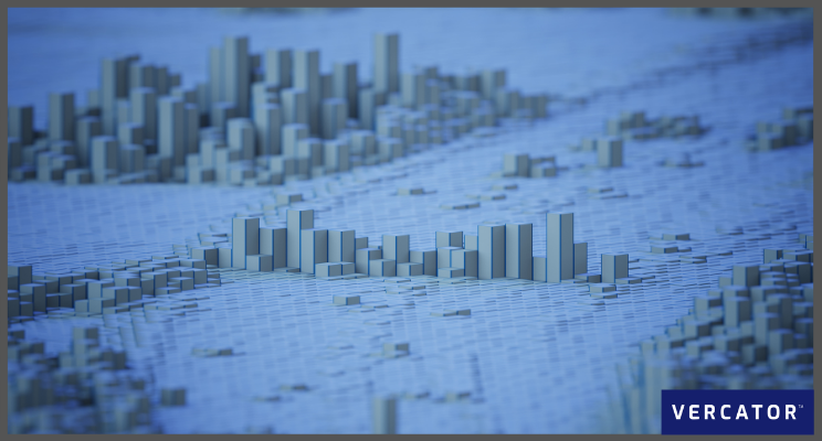
LiDAR continues to evolve at an increasing rate. Advances are transforming reality capture best practices and expanding viable use cases. Understanding the trends within LiDAR mapping will help you capture these new reality capture opportunities and upgrade your operation.
Here, we are going to look at the technical trends that are transforming the capabilities of LiDAR, 3D laser scanners and point clouds. However, something to keep in mind throughout is the outcome of all of this is the application of LiDAR within new contexts — and its expansion across industries ranging from transportation and automotive to industrial, agriculture, and its more traditional home: construction.
LiDAR systems have become small and light enough to be carried by drones or robots, opening up a much faster (and therefore lower cost) way of surveying. But the real advances in LiDAR mapping have not been due to hardware and devices but software. 3D scanners have been around for over 20 years now, and more standardised hardware has naturally led to the expansion of software capabilities and third-party integration. You’ll notice that most of this list is driven by new and exciting software capabilities.
Suggested reading: If you want to learn more about the technical software developments driving these LiDAR changes, check out our eBook — Point Cloud Processing Has Changed.
Trend 1: New processing algorithms
A significant challenge in the growth of LiDAR mapping is coping with the number of scans. Getting just enough detail, drilling down to see minute features, knitting together a wide range of scan types — all this makes LiDAR mapping more attractive, but your choice of software becomes crucial.
Fortunately, new AI-based registration algorithms are making this a reality. Multi-stage, vector-based processing simplifies and speeds the process substantially. Positional information of the scanner is used to extrapolate points into a direction vector. This adds an extra dimension to analysis and allows the entire point cloud to be collapsed into a ‘vector sphere’. By overlaying adjacent spheres, rapid rotational alignment is achieved. Once this has occurred, fast 2D point density analysis can be performed on adjacent point clouds to horizontal and vertical alignment.
The outcome is far faster and robust registration processes. Critically, this opens the door to hands-off registration — frontloading manual tasks and drastically reducing the number of work hours needed to oversee the process (particularly for large point cloud data sets). Increasing the speed of point cloud registration will be a trend that continues well into 2021 and beyond.
What you need to do
To enable the entire registration workflow to be accelerated, see how you can front-load manual tasks, or relegate them to the end of the process. Allow for the queueing up of scans for hands-off processing. Exploit this technology to create scans far more quickly and deliver them to users at a lower cost. Your ability to take advantage of these capabilities fundamentally comes down to the software you deploy. However, thinking about your workflows in this context is still important.
Trend 2: Cloud-based processing
The advent of cloud computing has profoundly changed many business sectors, and the same holds true for LiDAR mapping. The cloud enables registration processing software to have an even more profound effect on workflows.
Cloud impacts in several ways:
- Parallelisation of tasks: Scalability of computing power in the cloud allows you to take advantage of “parallelisation” — the simultaneous execution of computing tasks. With the right software (like that discussed in the previous trend) you can dramatically accelerate the registration of large data sets using this technique.
- Processing updates: Performance improvements, continually updated by faster cloud infrastructure, brings ever-increasing levels of functionality.
- Centralised data: Data seems to gravitate to itself. By storing all of a project’s information in the cloud, it is easier and cheaper to process and share the data at each workflow stage.
- Collaborative workflows: Many stakeholders are involved in any project. Sharing the same mapping data is crucial to everyone being on board throughout the project. An excellent example of this is Building Information Modelling (BIM).
What you need to do
Your ability to take advantage of these capabilities, again, comes back to the software you use. Fundamentally, you need processing tools that are cloud-enabled and can take advantage of the scalability of cloud computing. Things to consider:
- Try to avoid getting locked into a particular proprietary data format which will make sharing data difficult.
- Choose registration software that is cloud-native and is able to link to other software products via APIs.
- Focus on your end deliverable; make sure your chosen workflow will enable you to realise your end deliverable.
Suggested reading: We’ve addressed the potential of the cloud to disrupt LiDAR best practices in a dedicated ebook — Are You Ready for the Cloud?

Trend 3: Feature extraction and data classification
Point clouds are a collection of dots with XYZ coordinates. The more you can make those dots into useful information the more valuable scans become – especially further down the workflow. At some stage in the process, these dots have to be classified into features and objects. The faster and more automated you can make this process the larger the gains in gathering and sharing actionable and valuable information.
Traditionally, classifying objects was a manual task carried out by skilled operatives. The algorithms and AI used to register and align the scans are now being used to extract and classify features from these massive point clouds.
Point cloud classification trends point towards using trained algorithms to create a fully automated system. Eventually, this automatic verification will be good enough to assign classifications without the need for human intervention. Realistically, some manual cross-checking will be required for the foreseeable future, but this will not be a drawback in most cases. It will vary by project and the complexity (or novelty) of the data being analysed.
What you need to do
The key to success in LiDAR mapping is figuring out why you need data, what data you need, how best to capture this, and how you plan to use it.
By deploying cloud-based classification software, you can form a complete interpretation of a site or environment for both evaluation and analysis. Your own use cases will determine what type of classification you need, but look at who are your ultimate stakeholders (it may be your client’s clients) and ensure you can provide the outputs they will be able to understand and value.
Suggested reading: For more information on how to automate this process, check out our blog — How to Automate LiDAR Data Classification.
Trend 4: Mobile mapping and SLAM
The world is going mobile. We have already touched on the benefits of linking in-the-field data capture with in-the-cloud processing — when you factor in the growing range of scanning devices and methods, the impact of mobile will become even more profound.
While the static terrestrial scanner will always be the workhorse of scanning technology, it has had its drawbacks. They can be slow to set up, and require deliberate workflows. SLAM (Simultaneous Localisation and Mapping) is now automating rapid and low-precision data acquisition for indoor and outdoor spaces. Unmanned aerial vehicles (UAV) are enabling rapid capture of exterior structures and their surroundings.
Although each of these solutions have limitations (generally related to accuracy or their ability to function within indoor or confined spaces) each has huge potential to augment the outputs of traditional scanners. Using the right software, you can stitch together inputs from multiple scanner types — using each for the right use case and delivering the right level of detail where required.
What you need to do
Due to improvements in layering mobile and static scans, the enhancement in data quality will mean more mobile devices for even more applications. Start looking for SLAM capability in your scanner procurement.
To effectively deploy SLAM (and mobile scanning more generally), you need to investigate software that can combine mobile scanning outputs with the outputs of static scanners. This is an area of significant development within the industry and one you need to watch closely.
Suggested reading: If you want a detailed take on how to integrate mobile mapping into your workflows, check out our eBook — How SLAM Enables the Evolution of Wearable Reality Capture Technology.
Trend 5: The importance of software on workflows
LiDAR mapping presents boundless possibilities — from simple data sharing to simplifying complex and labour-intensive tasks. Software services will continuously improve and help teams extract intelligence from their point cloud data. Such tools are transforming a collection of points into detailed, valuable 3D models. Increased automation and accessibility is the major trend we expect to see in 2021.
Future trends will see a blurring of lines between software and hardware, with greater interoperability and platforms able to receive inputs from a wide range of data sources and types. Realistically, this comes back to the cloud-first and your ability to invest in future-proofed software to help you capitalise and exploit these trends without continually changing workflows to cope.
At Vercator, we’ve continued to pioneer advances in point cloud processing software, and can help you upgrade your workflow, get into the cloud and start capturing the new opportunities in reality capture. Get in touch, or start a free trial today.