5 ways 5G will impact the future of surveying

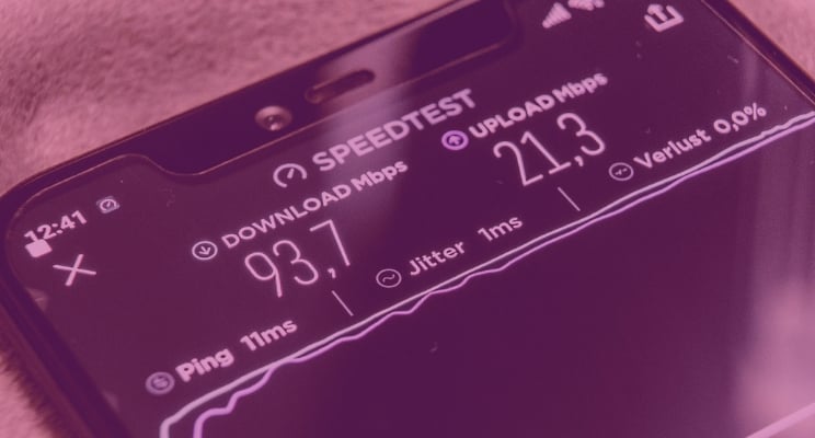
5G is the next generation of mobile communication. Data transfer speed will be 10 times faster than 4G. Speeds up to 20Gbps will be possible with at least 100Mbps everywhere.
But 5G is about much more than faster speeds. It will create the platform for everything in the coming IoT (Internet of Things) age. Technologies such as Augmented and Virtual Reality (AR and VR) will become commonplace with remote enablement delivered by 5G network speeds. 5G is the bedrock of the fourth phase of the Industrial Revolution and will change how, when and where we do things.
Together, all of these technologies will change the future of surveying, just as they will change large segments of every industry. How these survey change will manifest is what we will look at here.
1. Doing things faster — field registration and review
Faster internet speeds will mean more can be done. Both field staff and office-based staff will be able to communicate and send information to each other more quickly. In addition, field-based staff will be able to access documents stored in the cloud (such as plans) in no time at all. But when you combine 5G with cloud computing and storage, it will enable the vast amounts of data generated through LiDAR scans and point clouds to be processed in the field — with data uploaded to cloud services to be processed in real-time.
The scale of cloud communication offered by 5G will enable the work of field crews to be supervised and reviewed while being completed, allowing for instantaneous analysis and guidance from senior staff. This process will allow for more oversight, quality control and mentoring of field staff. The new technology will also allow for reduced timeframes when crews are required to provide field data for tight deadline requests and gives us a method of instant feedback on the amount and quality of the data collection.
2. Ensuring accuracy
5G will not only improve communication but data too. As machine-to-machine technology and the Internet of Things become more prevalent, the amount of data captured in the field will increase. 5G networks ensure there is the capacity to process this data in real-time.
Organisations making use of machine-to-machine technology will get faster updates, allowing them to resolve issues more quickly. In turn, this will see them able to deliver a better service. More data means more insights and more accurate insights.
3. Allowing better access
Obtaining accurate survey results is sometimes not possible. In places where surveyors have a hard time because of access availability or poor survey environments such as those surrounded by a mountain or sea, the construction site will now be accessed and analysed, using drones and satellite images. Landowners will be able to view survey records and discuss any questions with the surveyors in real-time through AR and VR.
The use of these types of technologies have been driven by a number of separate technological advances. Where 5G comes into the picture is by allowing for the interconnection of these data sources, and their live sharing in the field. Surveyors will not have to be physically present in dangerous or distant field locations. Survey results can be collected and stored systematically. We could even consider field scans being available to update new information continuously.
4. Reducing costs through information management
The ability to share and collaborate using 5G will enable design decisions to be made sooner and in real-time. When it comes to construction projects, for example, this will allow optimisation decisions to be made while it’s still cheap and easy to make changes, unlike latter phases, when alterations can have significant construction and lifecycle costs. Technology will directly reduce the number of errors and omissions during the design phase of the project.
Project managers will also experience fewer errors, reduced rework, shorter project durations and lower overall construction costs. The key to delivering these savings will be the full implementation of Building Information Modelling (BIM); and a key to implementing BIM is fast low latency mobile communications — 5G. BIM will also have a strong influence on project duration. One overseas report, which documented construction practices over several years, found that the average duration of BIM projects was 27% shorter than traditional projects.
BIM’s ability to integrate processes and ensure accurate, timely and intelligent transfer of information between key project stakeholders lies at the heart of its productivity gains. Many countries have already realised many of these gains, yet the overwhelming majority of organisations using BIM believe it has the potential to offer even greater value in the future.
5. Accelerating technology adoption
5G will have a direct positive impact on productivity. It will also have a major impact on the need for digital skills. The use of remote-control technology is beginning to look more and more feasible in construction projects. 5G will enable machines to be controlled with speed and precision. Video quality will be much better and connections more reliable.
A case in point for how this will impact surveying is Trimble who are developing solutions for drone-aided land surveying and cartographic transformation, as well as for enhanced operational efficiency of construction projects. The company has said it aims to commercialise its solutions by 2020.
Data collection processing and analytics
As mapping complex physical space becomes more manageable, multiple scans will have to be used to achieve enough coverage for downstream processing. Depending on the size of the project, the necessary number of scans will stretch into the hundreds if not thousands.
Fortunately, changes to how point cloud processing is undertaken are significantly reducing the cost of carrying out such 3D surveys. For outdoor, large scale projects, this is being delivered by positional data from GNSS and other positioning sensors. High-precision projects will benefit from the adoption of new, multi-stage, vector-based point cloud processing technology delivering automated and accelerated registration of multiple scans without the use of targets. Partnered with 5G, these kind of approaches to point cloud alignment can be undertaken rapidly in the field.
These advances are opening up the ability to capture spatial data in a point cloud to an ever-increasing number of projects. Without 5G, point cloud technology and LiDAR would not be able to realise this massive growth potential.
The impact and outcomes of 5G
The attributes of 5G are impressive: high data rates, low latency, reduced energy use and cost savings. These alone are great advancements, but what really sets 5G apart is its ability to act as an intelligent connectivity platform, which ultimately provides system capacity and massive device connectivity.
In the very near future, 5G will enable many new products and services that otherwise wouldn’t be feasible. For consumers, 5G can support the entire smart home with its slew of connected products, enhanced with videos and augmented reality.
But it’s in the commercial realm where 5G really shines, where it will enable new use cases associated with “Industry 4.0,” and, most notably, IoT.
The transition from 3G to 4G created the likes of Uber, Facebook and Instagram enabled by faster and better mobile networks. The question for surveyors and engineers will be: as 5G networks become more commonplace, what will be our applications of the future?
The drive for better connectivity will bring opportunity and risk for surveyors and engineers. But while technology offers greater efficiencies, it will also have its limits and professional judgement will still be vital. It will also become increasingly important to understand the full lifecycle of an asset, not just its value at a fixed point in time. We will need to think about how we also value the digital as well as the physical assets we create and manage. 5G delivers connectivity and flexibility — now is the time to start applying these capabilities in the field and make differences that drive better outcomes and efficiency.
Tags: surveying


